


Map of Melbourne and suburbs 1887 - Whitehead and Co
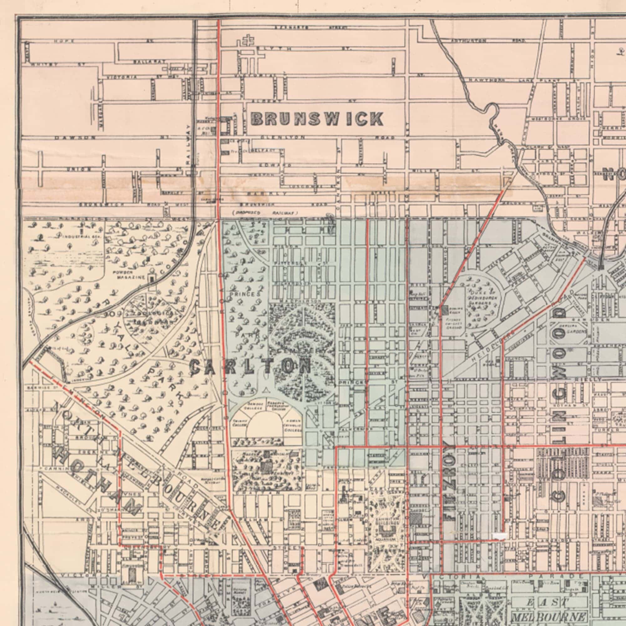
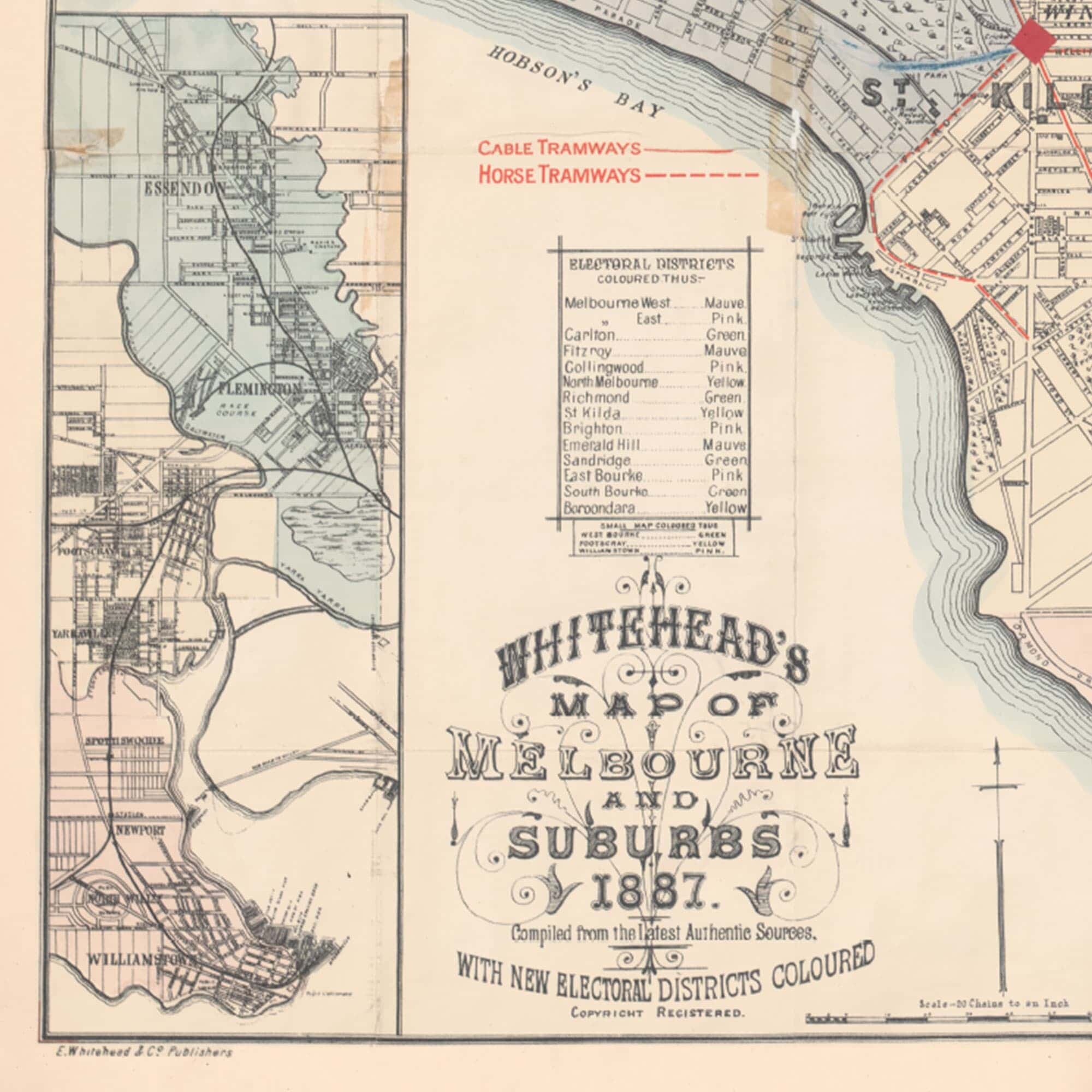
Whitehead's map of Melbourne and suburbs 1887. Compiled from the latest authentic sources, with new electoral districts coloured. Shows physical features; buildings and public grounds; roads, street tramways, horse tramways and railways.
Details of note: Docklands is the West Melbourne Swamp; removed suburb names of Emerald Hill (now South Melbourne), Sandridge (now Port Melbourne), Hotham (now North Melbourne); and, the outer suburbs of Kew and beyond being mostly orchards.