
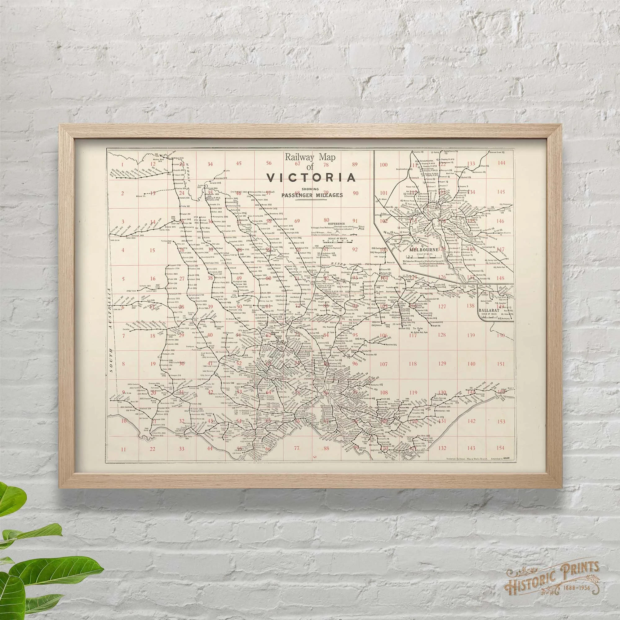


Railway Map of Victoria showing passenger mileages 1937 Poster Print
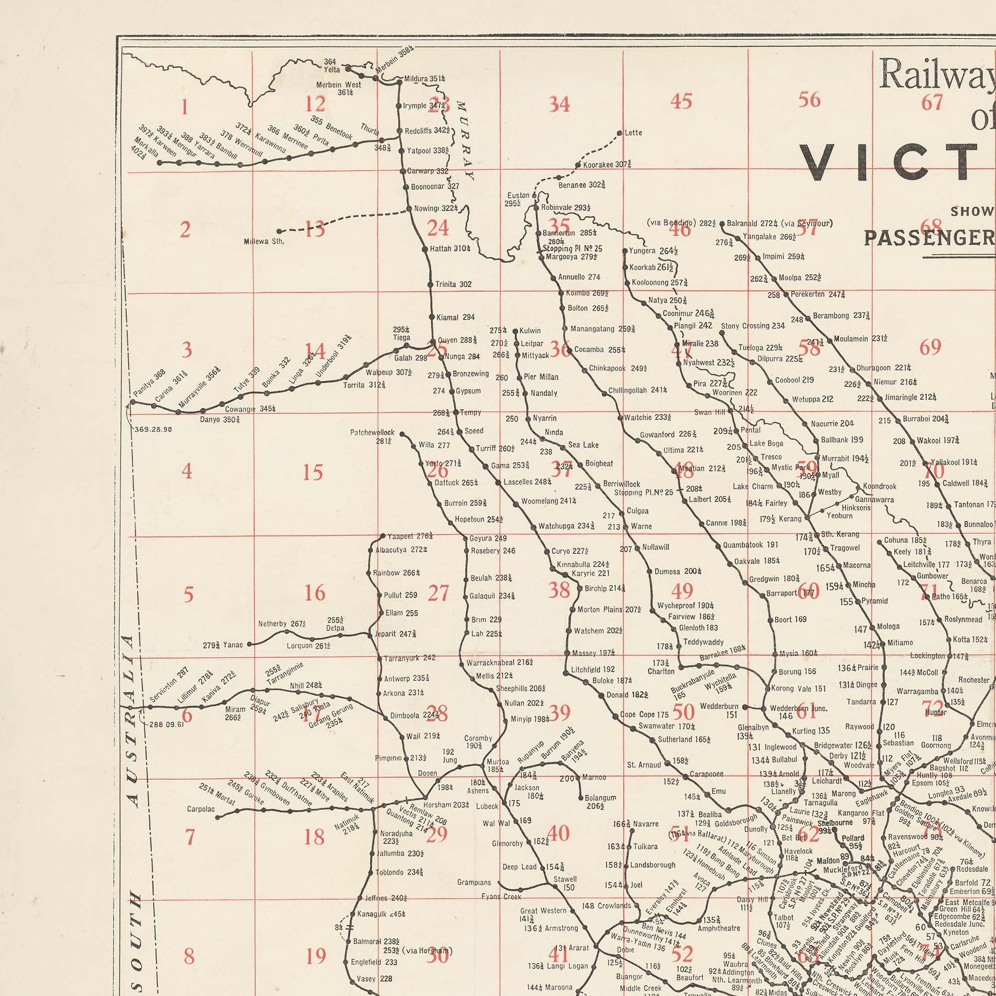
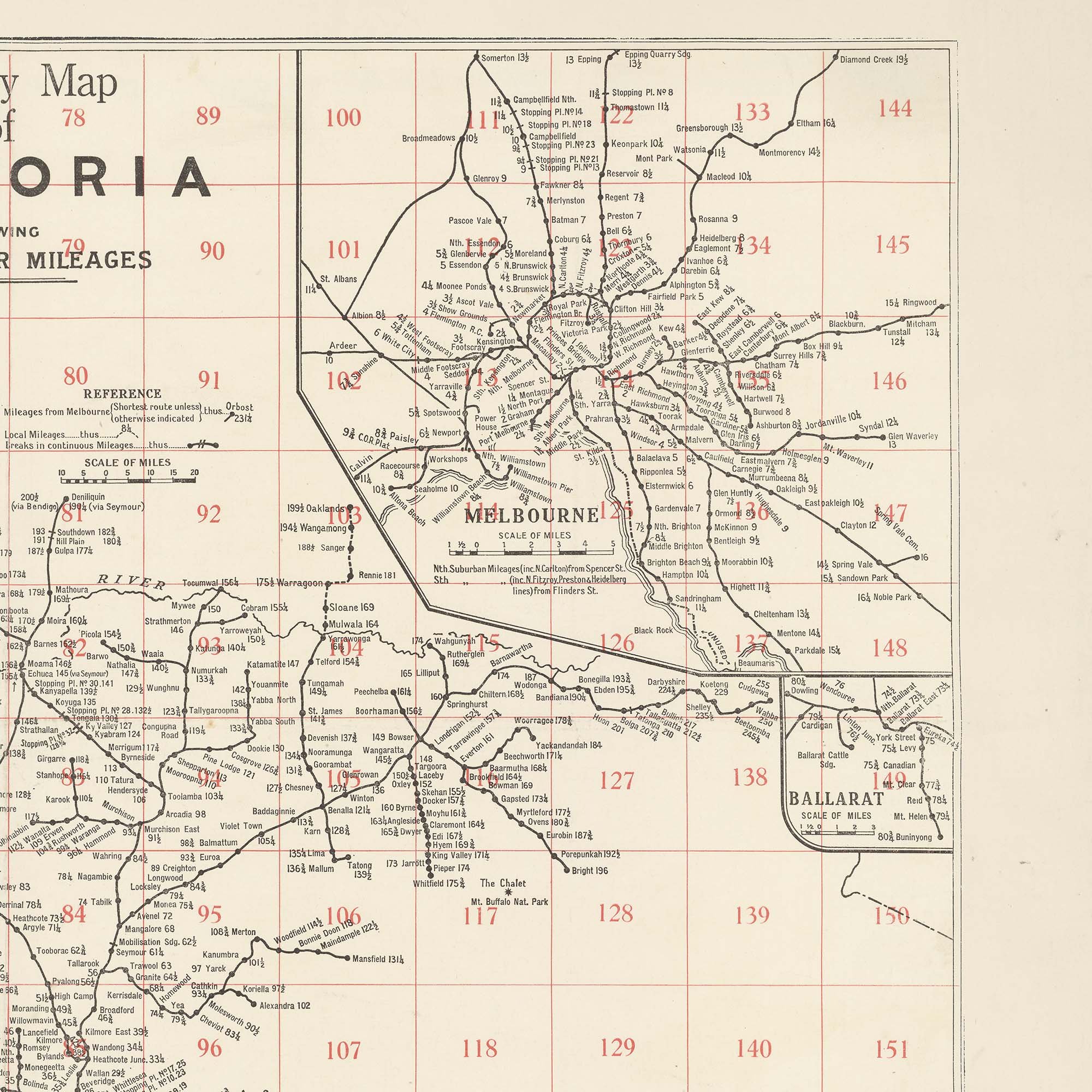
A beautifully detailed Way & Works Branch map of the Victorian Rail Network as it stood in 1937. Post war optimistim additions to the network, particularly in the wheat growing areas in the north west and west, saw this map explode into hundreds of stations and tens of lines that do not exist today. One of the most interesting features of the map is that it displays each station’s distance in miles from the centre of Melbourne. For northern lines, the distance is measured from Spencer Street Station whereas for southern lines this is calculated from Flinders Street Station.
We also have another Railway Map “Railway Map of Victoria showing passenger mileages with index 1934” in the store if you would like the expanded index option.