In 1840, Robert Hoddle and his assistants surveyed the area and created this first estate map for the purpose of dividing the land into referenced sections for ownership tracking for the Crown. This was also the very first documented reference to the name “Cut Paw Paw”.
The Parish of Cut Paw Paw contains the suburbs now known as Williamstown, Footscray, Yarraville, Seddon, Newport, Kingsville, Maribyrnong, Brooklyn, Braybrook and Maidstone. Kororoit Creek and the Maribyrnong River (originally known as Saltwater River at this time) are the boundaries of Parish division in the County of Bourke. If you look back at your home purchasing documents, you'll notice this reference still today.
This 182 years old hand-drawn map of the Parish of Cut Paw Paw is the very first map of its type. It’s exceptionally old and beautifully textured. It provides a snapshot of the sparse land scattered with the She Oaks that the name Cut Paw Paw originates (meaning Many/Clumps of She Oaks).
There are other Cut Paw Paw versions available in the store.
 Image 1 of 11
 Image 2 of 11
 Image 3 of 11
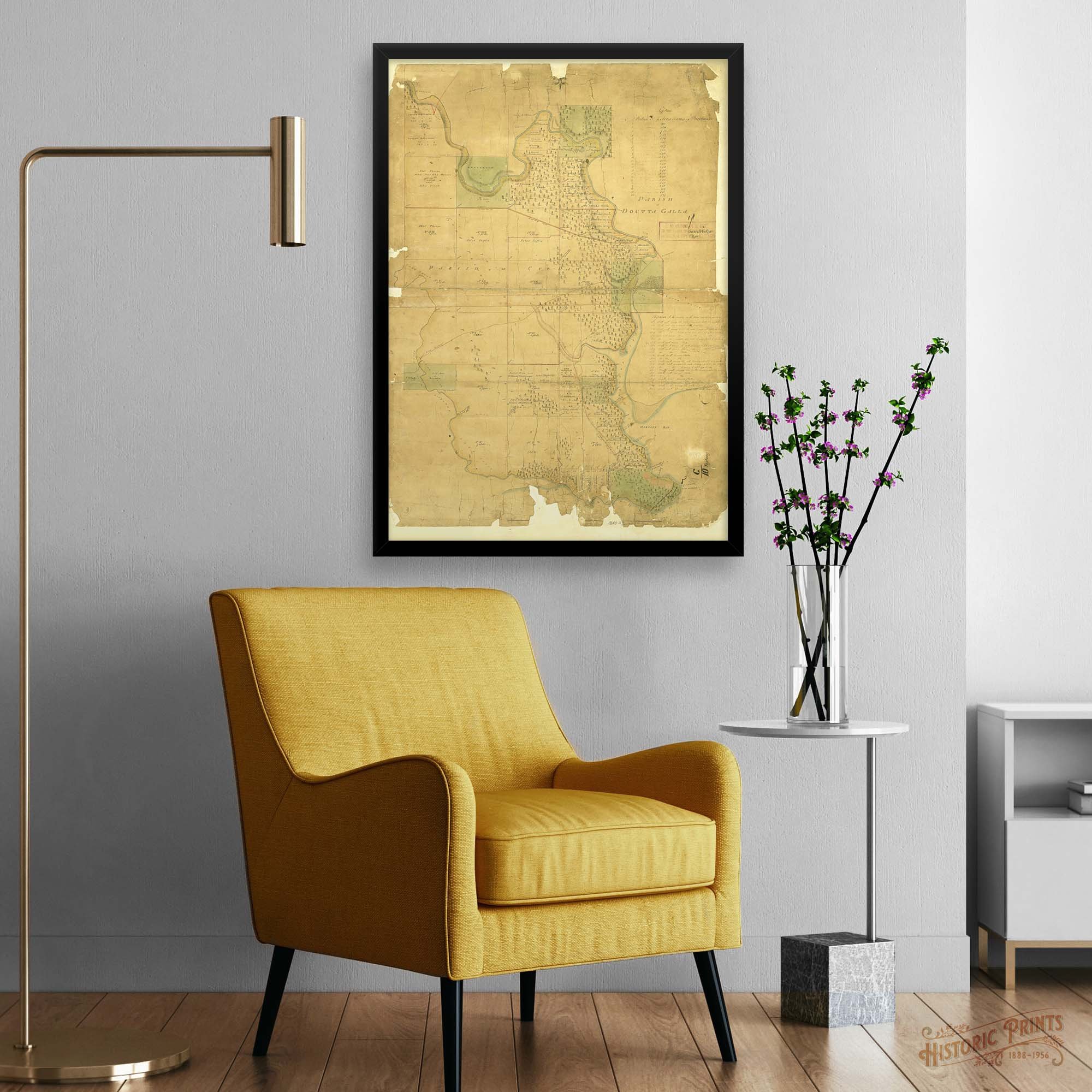 Image 4 of 11
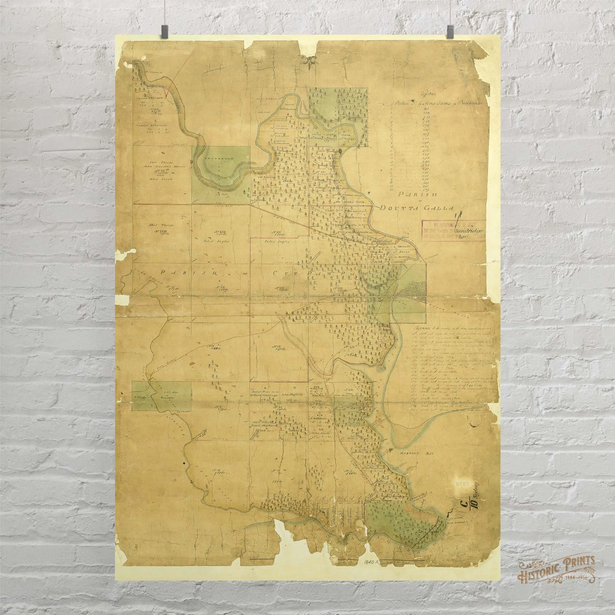 Image 5 of 11
 Image 6 of 11
 Image 7 of 11
 Image 8 of 11
 Image 9 of 11
 Image 10 of 11
 Image 11 of 11