How do you track land ownership when you colonise an entire country? You break each state up into divisions called counties, which are further subdivided into parishes and then into townships. Land settlement records in Victoria are divided in 37 Counties, which are made up of 2004 Parishes and 909 Townships. Parish and Township Plans show freehold land dealings or land occupancy up to the date of the original Crown Grant.
In December 1837, Surveyor Henry Smyth was sent out by Robert Hoddle, to survey the Mone-Mone Creek. The land west of the creek was named “Doutta Galla”. This map is from 1937 and contains all the land owners and land lot sizes. If you want to know who originally held your original plot of land, this map will have it.
 Image 1 of 10
 Image 2 of 10
 Image 3 of 10
 Image 4 of 10
 Image 5 of 10
 Image 6 of 10
 Image 7 of 10
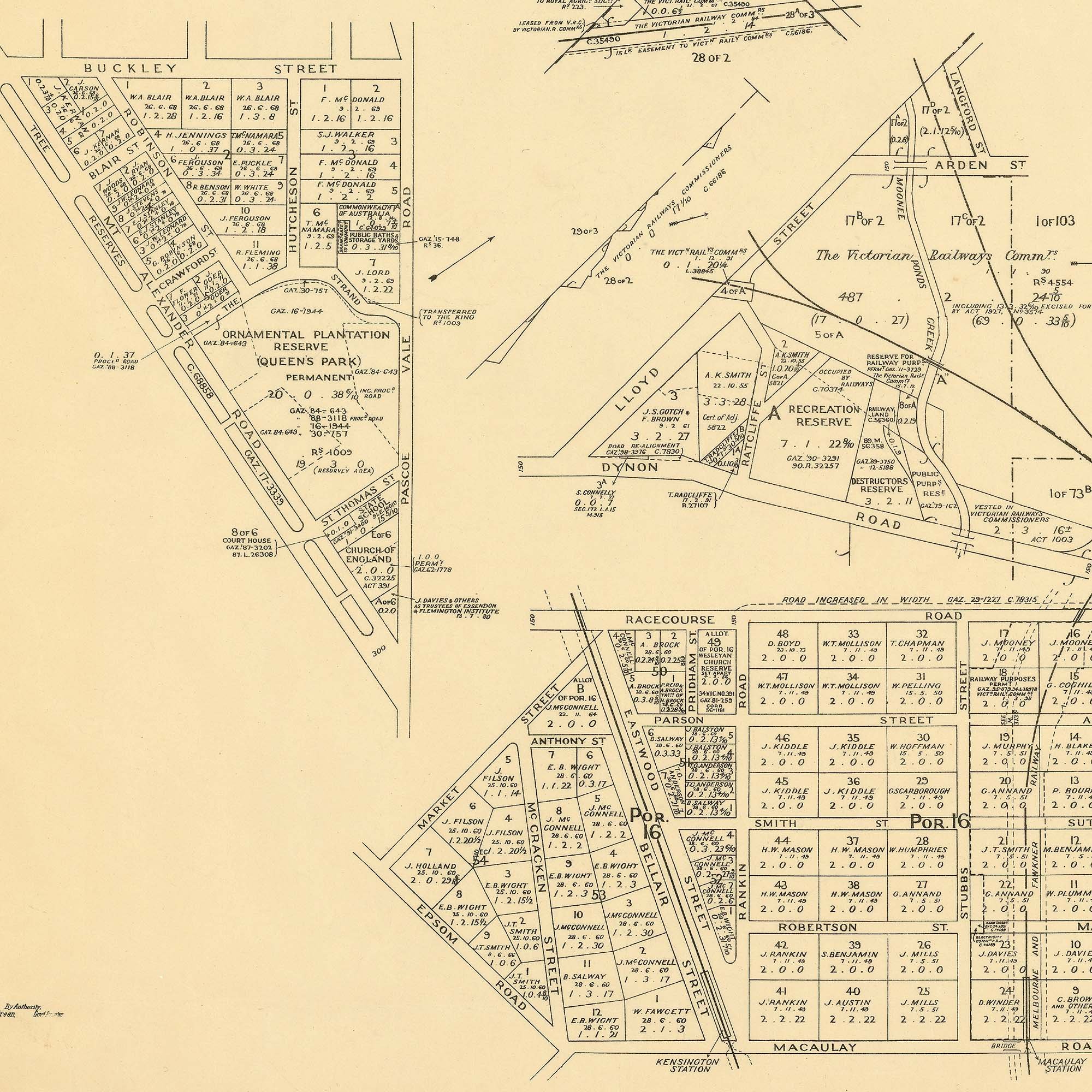 Image 8 of 10
 Image 9 of 10
 Image 10 of 10