If you live just east of Newport Lakes Reserve, this is your neighbourhood’s original estate auction plan from 1853. This historic map details the early subdivision of the area encompassing Blackshaws Road, Melbourne Road, Schutt Street (then known as Union Street), along with William, Elizabeth, Oxford, Johnston, and Junction Streets.
In 1853, Newport was on the edge of transformation, beginning to feel the trickle of growth spilling over from Melbourne’s booming inner suburbs. The quarry that would one day become Newport Lakes Reserve was little more than open paddocks. Cattle grazed freely, early steam trains rattled along the rails, and the sails of merchant ships could be seen drifting along the Yarra Yarra River.
Beneath the plan, a hand-drawn artist’s impression captures a rare glimpse of the area as it may have appeared—sparse, pastoral, and peaceful—with a handful of tall ships anchored near what we now know as Sandy Point Nature Reserve.
This artwork is reproduced at high resolution and is suitable for printing up to A1 size.
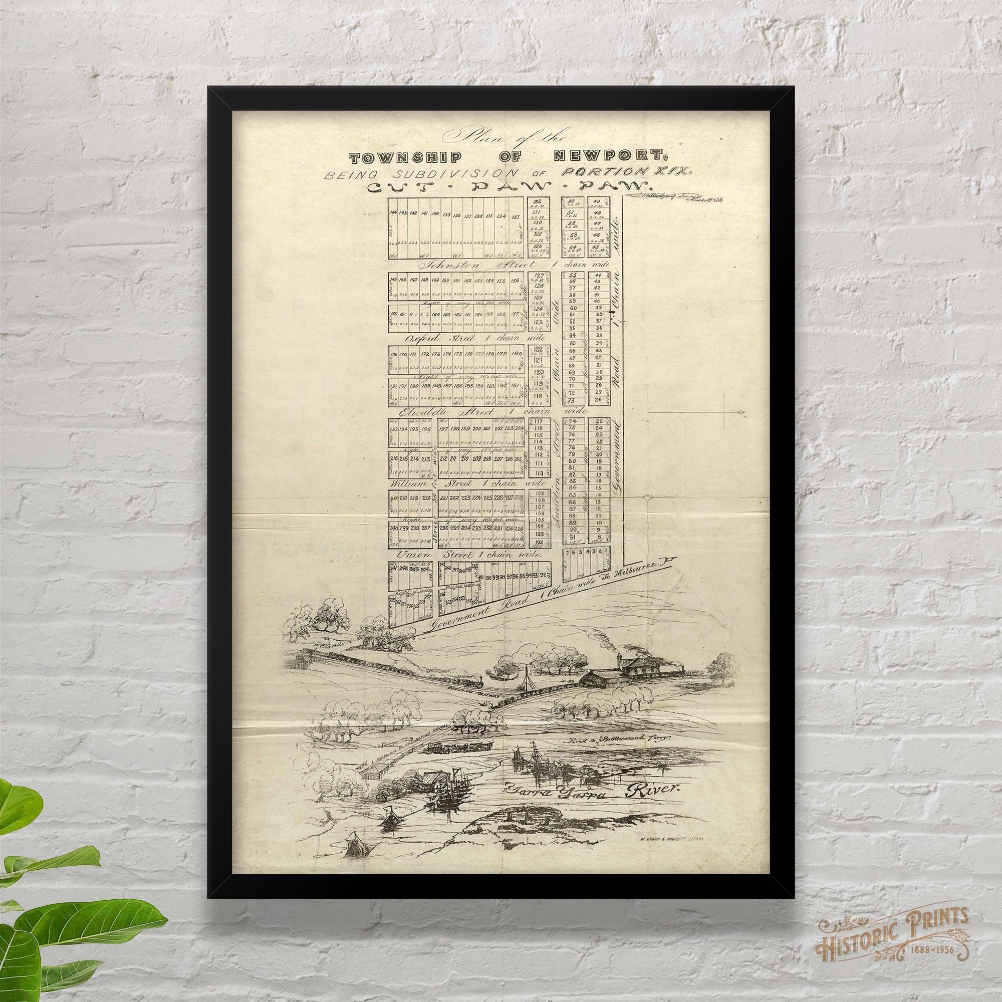 Image 1 of 10
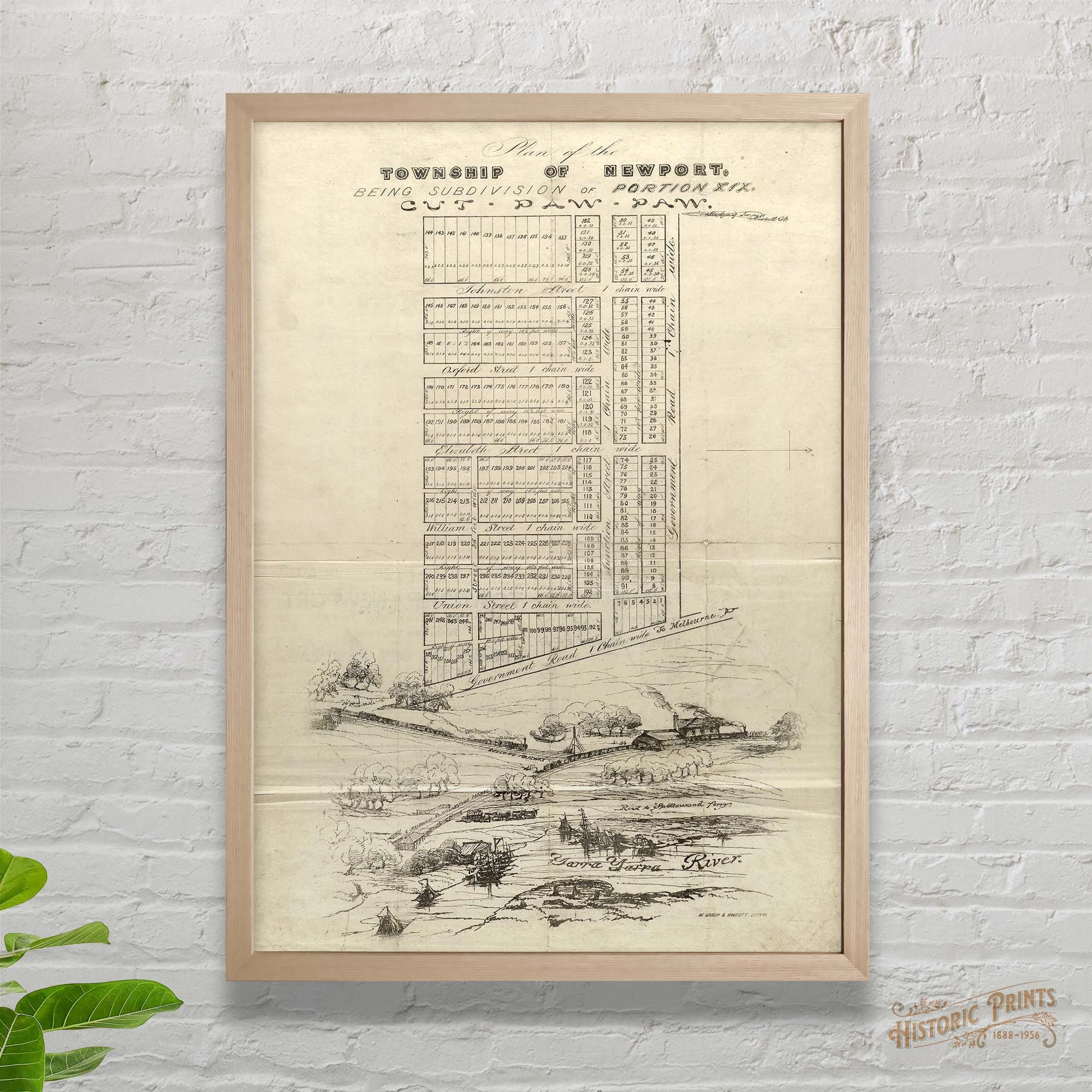 Image 2 of 10
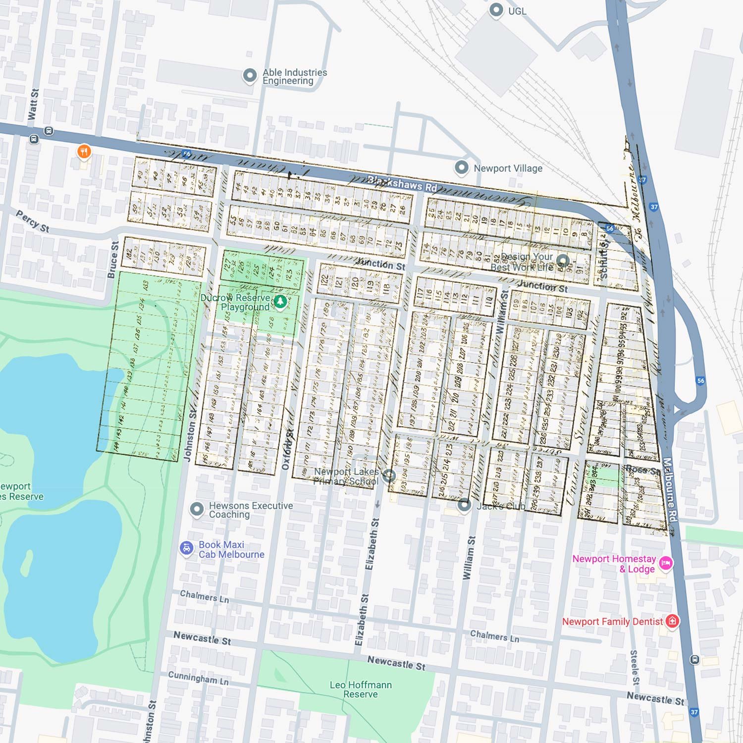 Image 3 of 10
 Image 4 of 10
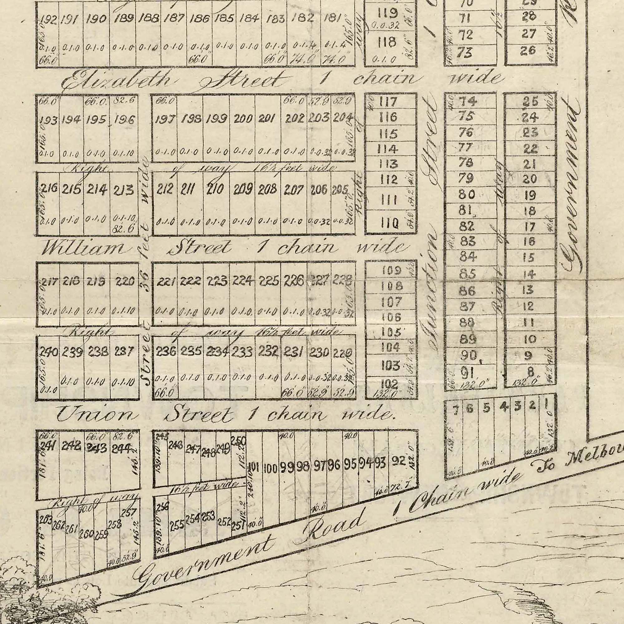 Image 5 of 10
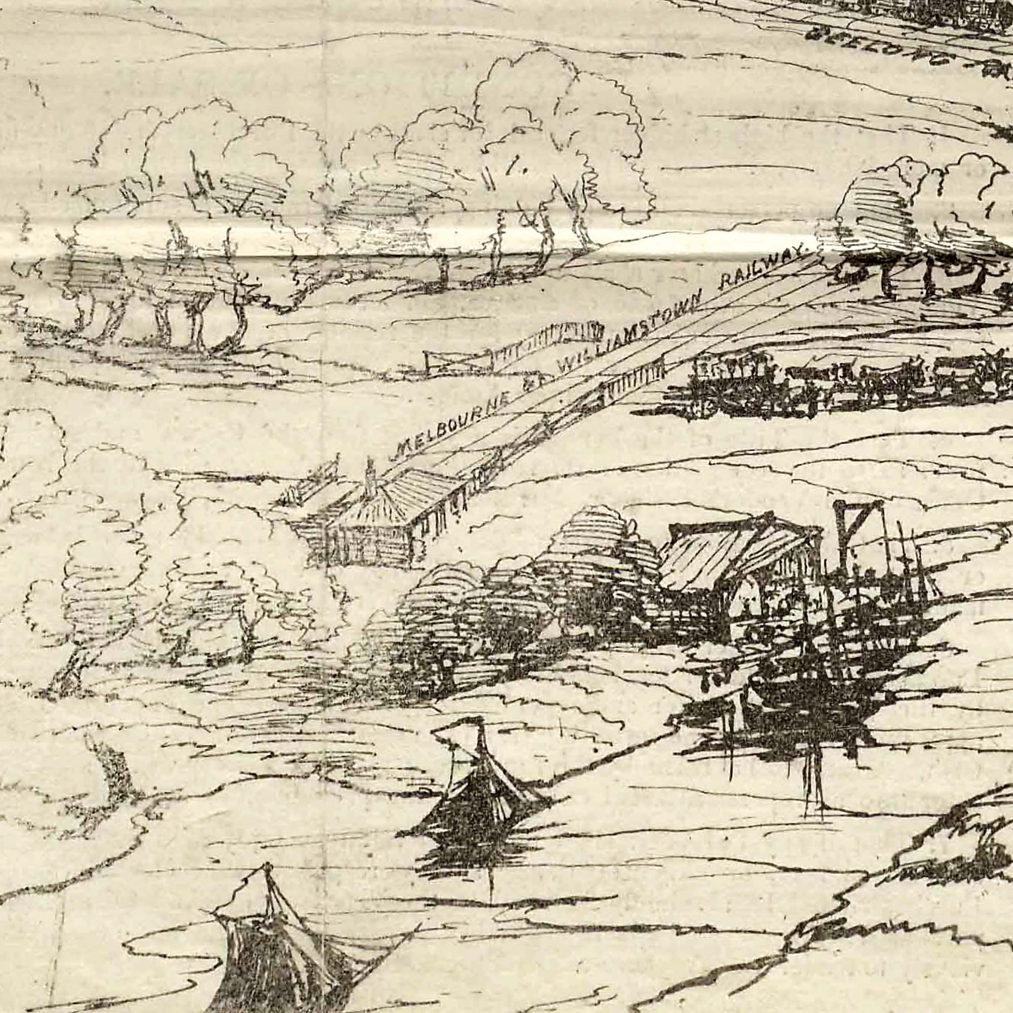 Image 6 of 10
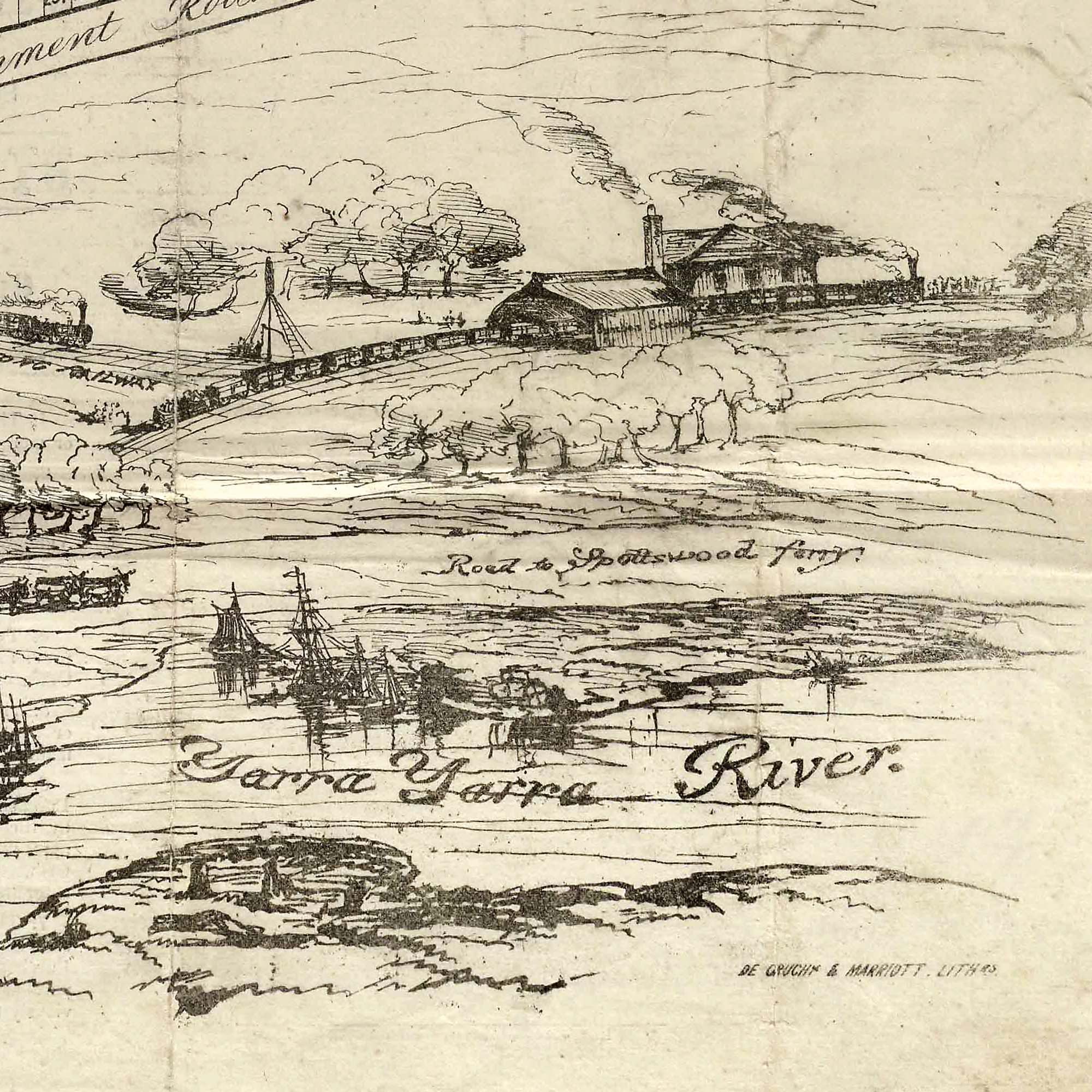 Image 7 of 10
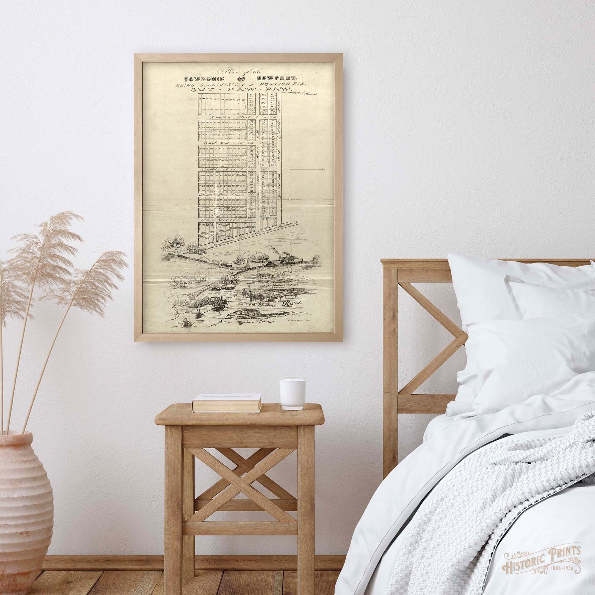 Image 8 of 10
 Image 9 of 10
 Image 10 of 10